50th Anniversary of Oregon’s Land Use Program
Five Iconic Landscapes Saved by the Program
Happy New Year to all who have supported Thrive for the last 46 years, those who joined us last week, and the 2,000 supporters in between.
2023 is the 50th anniversary of Oregon’s Land Use Planning Program, generally recognized to have been conceived by Tom McCall’s signing of Senate Bill 100. 2023 is a year to pause and reflect on the high-minded Oregonians that spared Oregon from many of the most heinous planning trends of the 20th century. I’m thinking of Governor Tom McCall of course, but also, folks like Hector MacPherson, Bob Stacey, Henry Richmond, Dick Benner, and Robert Liberty. I’m thinking also of Kate and Jack Mills and Kate McCarthy who ensured the Hood River Valley was front and center in the land use conservation mosaic. In the 1960s and 1970s–the heyday of exurban sprawl, freeway bisections, and strip mall metastasis–these leaders stopped and said, “not in Oregon.”
The precise McCall quote was:
“Sagebrush subdivisions, coastal condominia, and the ravenous rampage of suburbia … threaten to mock Oregon’s status as an environmental model…Oregon … must be protected from the grasping wastrels of the land.”
Tom McCall is no longer with us, but a few months ago, I asked another towering figure, former Governor John Kitzhaber, to attend one of our events and deliver an assessment of Oregon’s land use program’s past and future. You can find his keynote addresses here.
Finally, in honor of this 50th anniversary, I wanted to take a step back and memorialize five Oregon landscapes preserved by our land use program.
1. Sauvie Island
“Sauvie,” as it’s often called, is a fluvial island that harbors farmland and wildlife reserves, wetlands and pumpkin patches, beaches, and volcanic vistas. All these unlikely bedfellows are often cleaved apart by canal-like waterways under the backdrop of Mount Saint Helens. Such a place must be remote, one would think. But this pastoral island is an improbable 20-minute drive from downtown Portland.
Sauvie’s proximity to Portland could have made for a convenient suburban enclave. This was the fate of farmland within short commutes of urban centers across America–from Hayward (near San Francisco) to Orange County (near Los Angeles). But Oregonians, and the land use program, had a better plan for Sauvie.
Our land use program did not zone lands based on the possibility of suburban commutes. The program zoned lands based on their physical, chemical, and scenic qualities to sustain life, resources, and a sense of place. Today, 12,000 acres of Sauvie Island are designated as a Rural Reserve. This allows dozens of small family farms to exist alongside wildlife.
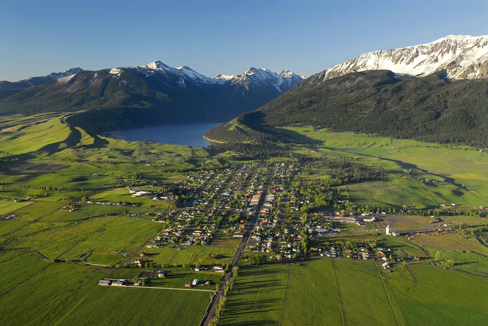
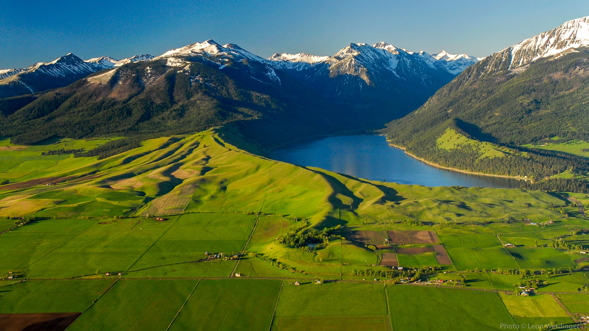
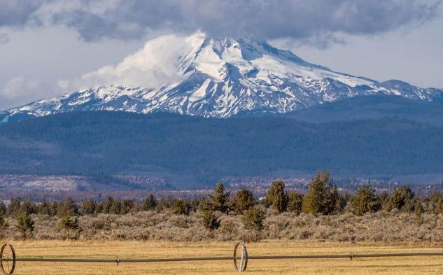
2. The Wallowa Mountains and the Wallowa Valley
These are not the mountains Hannibal traversed to outflank Rome’s legions, but almost. Sometimes referred to as “Oregon’s Alps,” the Wallowa Mountains speak for themselves. There are no worthy adjectives I could provide.
The aerial view of Joseph, at the shores of Wallowa Lake, is the face of a land use program that serves communities’ sense of place, not the sprawling needs of ranchette owners looking for a third home. As you can see, Joseph’s 1,140 residents’ views and access to the Wallowas are unobstructed, and their home prices are reasonable.
But places like Wallowa County are out of the ordinary. Let’s take two other counties, rich in alpine beauty but living under a different land use regime–Gallatin and Park Counties in Montana. In Park County, more land is zoned for big box stores, motels, and casinos outside the county’s city limits than within. Massive resorts are common. Last year, for example, the famed 18,000-acre Marlboro Ranch in the Shields Valley was sold to a resort development company, which will likely tarnish the Shields Valley forever. The price of housing in Park County hovers around the $600,000 median.
Gallatin is also known for uncontrolled sprawl climbing up to its mountains. As a local journalist, Tod Wilkinson, wrote in the Mountain Journal, “Gallatin County has for the last half-century been notoriously anti-planning and zoning, noted for allowing visual blight to creep along roadsides, enabling a proliferation of individual septic systems, some of which have failed over time, and its laissez-faire, permit-almost-anything attitude earned it distinction as ‘the gravel pit capital of Montana.”
Our land use program spared Portland from the fate of cities like Phoenix or Dallas, which have sprawled so uncontrollably their footprint is larger than cities five times as big, like Mexico City or Paris. Our land use program has also spared places like Joseph from the fate of resort towns like Vail, and Telluride and rural communities rich in scenic lands like Gallatin.
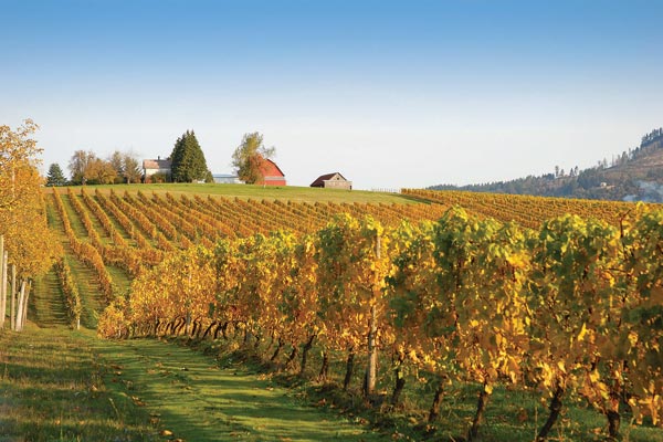
3. The Chehalem Mountains of the Willamette Valley
Oregon was not always known for its world-class wine scene. Without our land use program, we may have lost some of our best American Viticultural Areas (AVAs) to urban sprawl. Indeed, the Willamette Valley is a mere 20-minute commute from SW Portland.
I recently had the chance to visit one of our supporters and reputed vintner, David Nermanick, at his Alloro Vineyards tasting room. David is a strong supporter of the land use system. He explained to me how Alloro vineyards used to be low-value hay fields. The decision to preserve them at the expense of Metro subdivisions was controversial.
Today, the hillsides of the Chehalem Hills, the gateway to the Willamette Valley, are some of the most sought-after AVAs in the United States. Two unique geographic features make this a haven for grapes: the oceanic winds that funnel through the Van Duzer Corridor to cool the Willamette Valley in summer and winter, and secondly, the shelter provided by the Chehalems from our rugged Columbia Gorge winds, which, unlike other Eastern winds, seep through the Cascades.
Thanks to a land use program, today, close to 730 wineries–most of them small–tend to 27,000 acres of wine country blanket the Willamette Valley’s many microclimates and AVAs. That is more wineries than all of Napa Valley, though Napa is twice as large.
4. Jefferson County Farmland
Jefferson County boasts 397 operating farms and the most productive agricultural land in Central Oregon. Its shallow, well-drained soil makes it prime vegetable and seed-growing land that make up a $67 million industry in the 24,000 person County.
Its proximity to some of Oregon’s most beloved landmarks, such as Smith Rock, has made it the site of a number of destination resort proposals. In the 1990s, our friends at 1000 Friends of Oregon and a coalition of farmers put up a formidable battle that lasted until 4th of July midnight at the Oregon Legislature to block a giant destination resort that would have spanned hundreds of acres at Smith Rock’s very edge.
Today, our good friends Central Oregon Landwatch keep a watchful eye over these precious lands. Most recently, they fought a battle to prevent the sprawl of Metolius onto 67 acres of prime farmland.
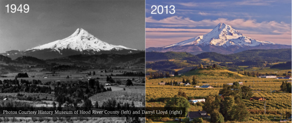
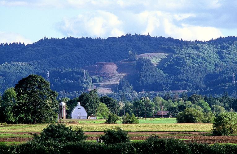
5. The Hood River Valley
Few words are needed here. I always say the Hood River Valley is Oregon’s crown jewel. When you walk into our friends’ at 1000 Friends of Oregon’s office in downtown Portland, perched in the main room is a painting depicting the lavender fields of the Hood River Valley with Mount Hood in the backdrop. We all know this picture. It’s one of Oregon’s most recognizable state emblems, and we cannot take it for granted.
The Hood River Valley is one of the most productive orchard lands in the nation. Our orchardists are the top fruit producers in the state and stand in the nation’s top percentile. In this way, the Valley is a resource land of national and geopolitical importance. Further, as California’s farmland continues to dry up in traditional breadbaskets like the Central Valley, the Hood River Valley will become an even more indispensable resource.
But farming is hard work, and without land use planning, Hood River Valley farmland’s most profitable use would not be in farming but in the real estate market for scenic homes and other commercial uses of the land. By constraining development rights, our land use program tries to keep farmland accessible to those seeking to make a profit by selling crops, relieving farmers from the pressures of sprawl, subdivisions, and resorts, in high-value real estate markets like the Hood River Valley. Unfortunately, the land use program can only deliver these public benefits if it is enforced. Lax enforcement is one of the reasons why Hood River County has the priciest acre of farmland in Oregon today. When the market perceives a proliferation of commercial and non-farm uses, like restaurants or wedding venues on high-value farmland, new buyers become willing to pay a higher price than someone looking to buy land to farm it.
Despite these challenges, the picture below speaks for itself.